Lower Berryessa Creek Flood Protection Project
Valley Water is dedicated to keeping residents and businesses safe through its flood protection programs. The Lower Berryessa Creek Flood Protection Project will provide 100-year flood protection to approximately 1,820 homes, schools, and businesses in Milpitas.
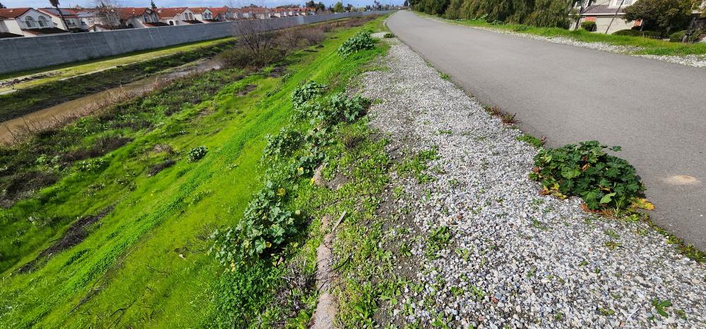
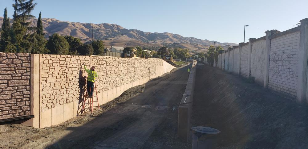
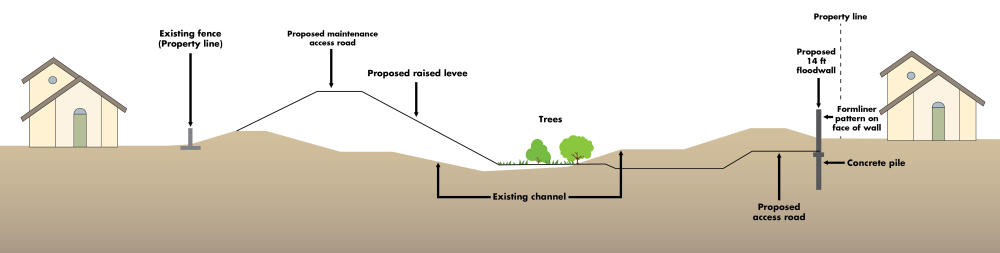
When complete, the Lower Berryessa Creek Flood Protection Project will provide new floodwalls, improved levees, and widened creek channels to accommodate high flows. This is in addition to enhanced and enlarged tidal and freshwater wetlands and riparian habitats.
The Calera Creek Flood Protection Project is part of the larger collection of flood protection improvements under the Lower Berryessa Creek Flood Protection Project.
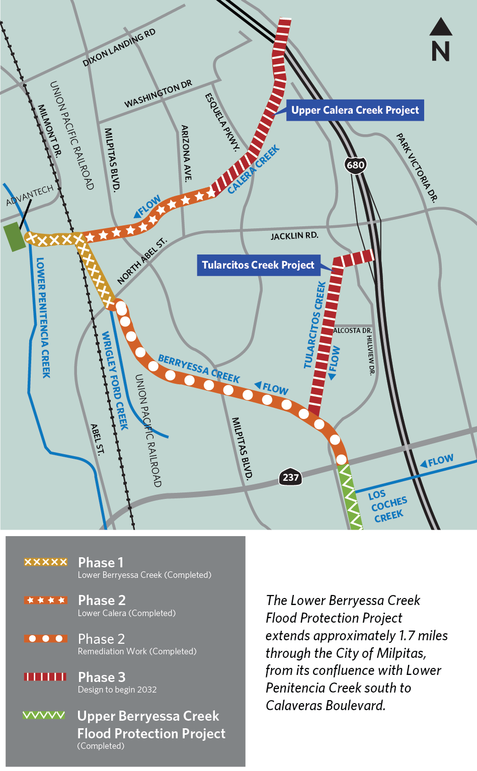
Three flood protection sections of Lower Berryessa Creek and Calera Creek Completed
Phase 1 (Completed)
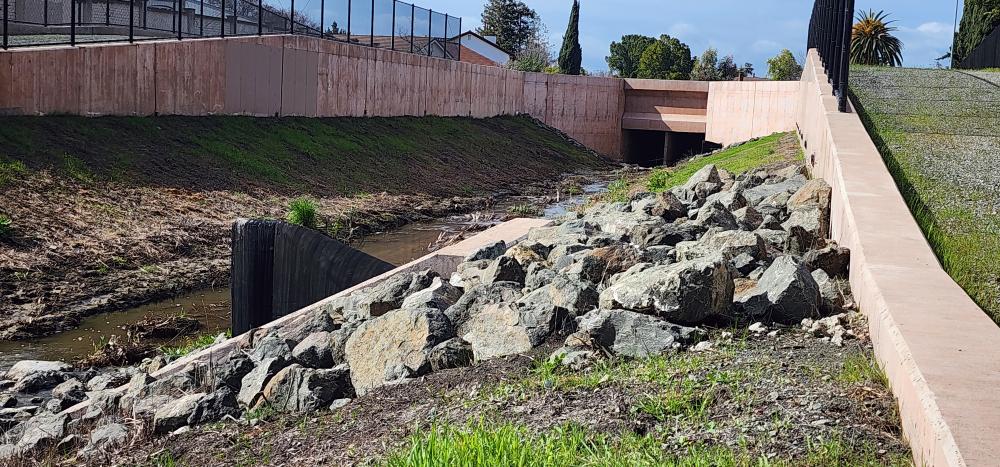
This phase stretches from the confluence at Lower Penitencia Creek to Abel Street. The flood protection improvements include earthen levees on the east and north sides of the creek and 6-to-9-foot concrete floodwalls on the west and south sides of the creek. Revegetation of freshwater wetlands was established within the creek channel. Construction of Phase 1 was completed in December 2016.
Phase 2, Lower Berryessa (Completed)
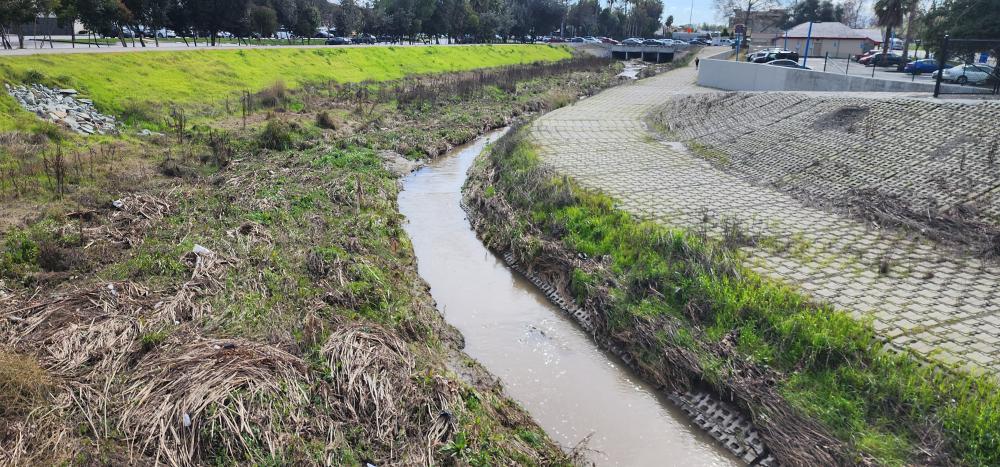
This phase has two sections. The first section of Phase 2 is along Lower Berryessa Creek, stretching from Abel Street to Calaveras Boulevard. The flood protection improvements for this section included improved earthen levees on the north side of the creek and concrete floodwalls on the south side of the creek.
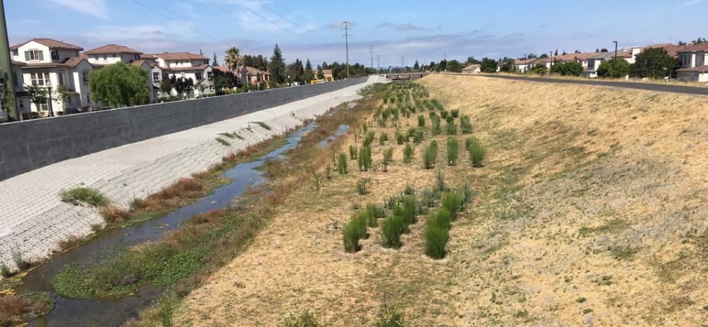
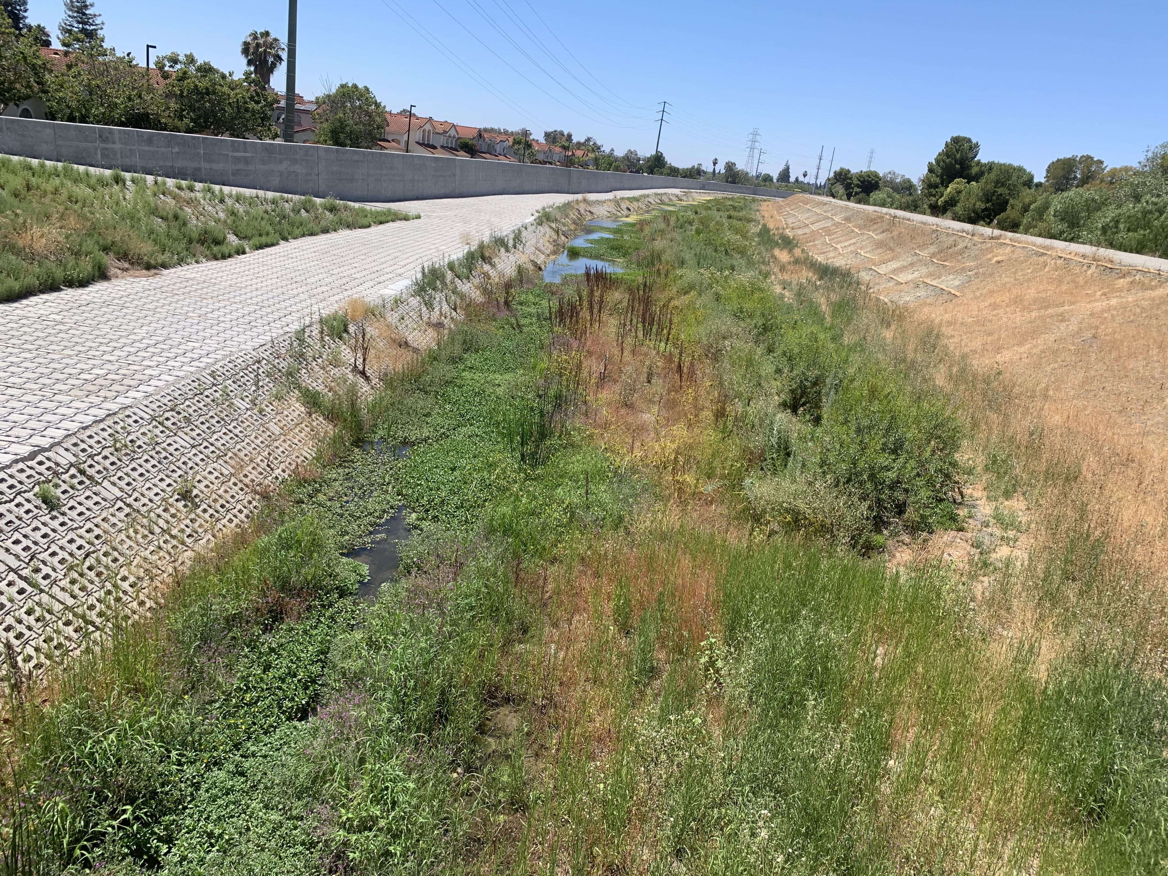
An area for riparian habitat was included in the creek channel. Construction of this section was completed in July 2020.
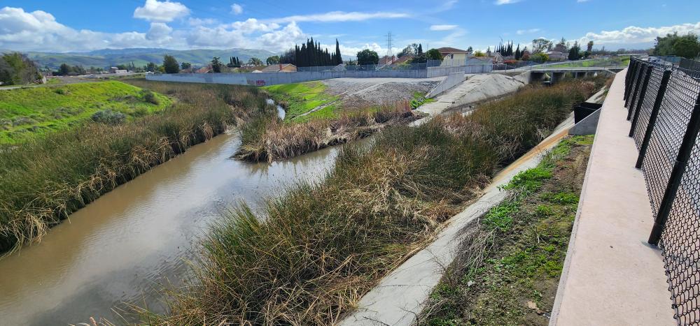
Phase 2, Calera Creek (Completed)
The second section of Phase 2 is along Calera Creek, stretching from the Lower Berryessa Creek confluence to the drop structure (see map). The flood protection elements of the project were completed in mid-February 2024. The monitoring of the native plants will continue through December 2025 to ensure successful plant establishment.
Phase 3: Tularcitos Creek and Upper Calera Creek
Design for Phase 3 is slated to begin in 2032 and includes Tularcitos Creek and Upper Calera Creek, which are two tributary creeks of Lower Berryessa Creek. Funding options are being explored to pay for the construction cost. Once constructed, this project will provide 1% (100-year event) flood protection to 1,100 parcels affected by Upper Calera Creek from the drop structure upstream of Arizona Avenue upstream to José Higuera Adobe Park, and to an estimated 320 parcels along Tularcitos Creek between its confluence with Berryessa Creek and Interstate 680.
Phase three is funded by the voter-approved Safe, Clean Water, and Natural Flood Protection Program.
Click here to view the project shell with a map of the area, benefits, and timeline.
Updated February 2024.
For more information:
- Contact Public Information Representative Jose Villarreal at (408) 630-2879 or by email at [email protected].
- Use “Access Valley Water” to submit questions, complaints, or compliments directly from your computer to a water district staff member who can help you.
- Sign up to receive project updates via email.