E1: Coyote Creek Flood Protection*
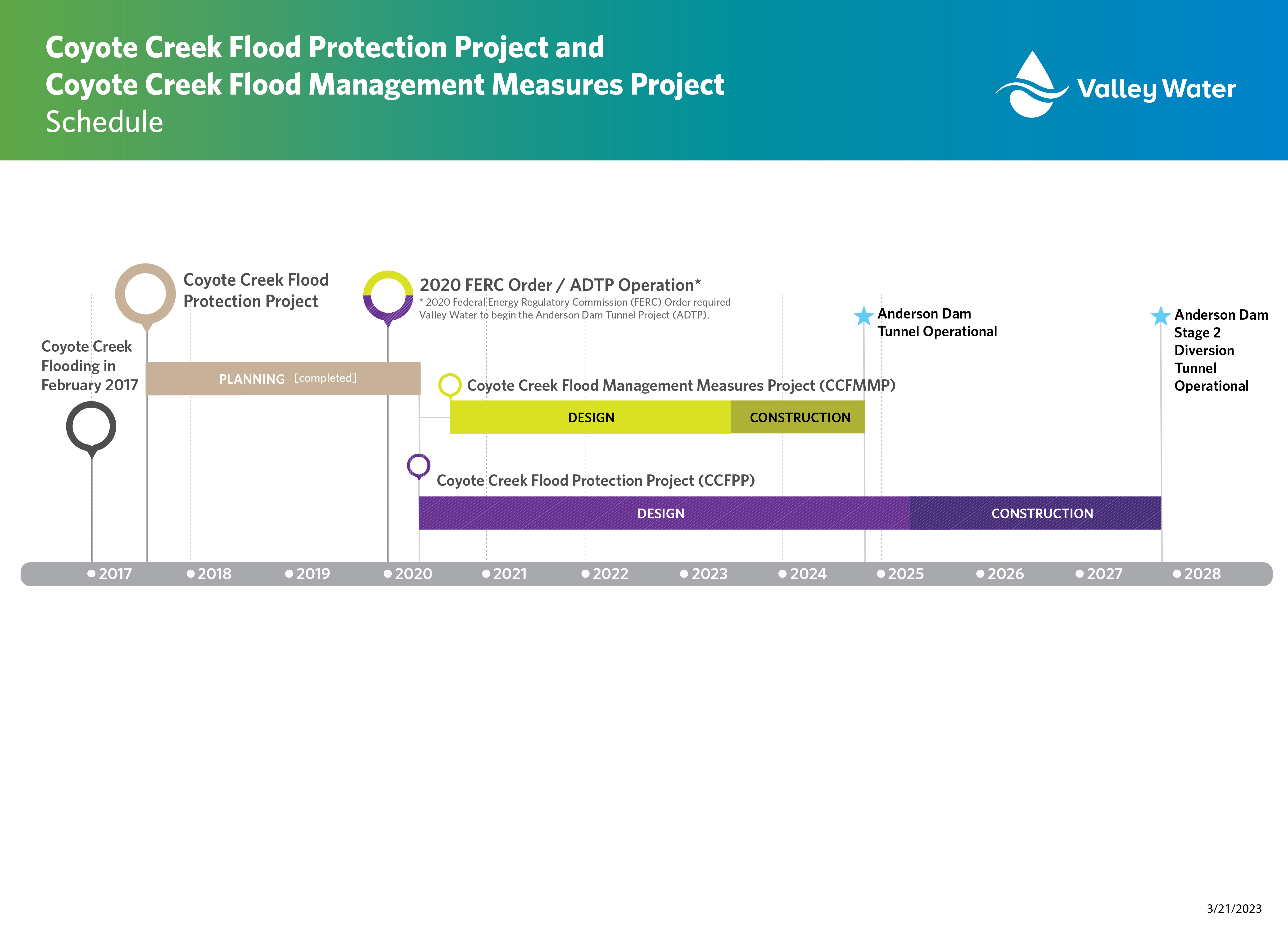
This project is to plan, design and construct improvements along approximately nine (9) miles of Coyote Creek, between Montague Expressway and Tully Road, in San José. The primary objective is to provide protection from floods up to the level that occurred on February 21, 2017, equivalent to approximately a 5% flood (20-year event). In December 2019, the Valley Water Board of Directors voted to allocate local funding for construction of the preferred project; however, Valley Water is also exploring additional external funding sources and partnership opportunities.
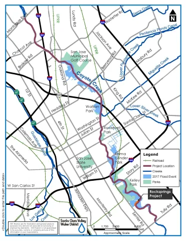
Since 2017, Valley Water has implemented several short-term interim projects to help reduce the risk of flooding along Coyote Creek. These include the installation of an interim floodwall and embankment along the creek in the Rock Springs community. This structure protects the Rock Springs community from a flood event equivalent to the February 2017 flood. Other interim projects include repairing a 150-foot levee adjacent to the South Bay Mobile Home Park, installing flood gauges on bridges that provide real-time visual information on water levels and removing invasive vegetation from Valley Water and City property in parts of the creek that experienced the most flooding.
|
|
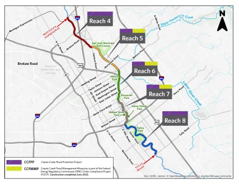
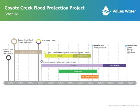
The Coyote Creek Flood Protection Project comprises two projects: the Coyote Creek Flood Management Measures for the FERC Order Compliance Project (CCFMMP or Phase 1) and the Coyote Creek Flood Protection Project (CCFPP or Phase 2). These phases cover a 9-mile stretch of Coyote Creek between Montague Expressway and Tully Road. This area is divided into several geographic segments known as reaches, which are shown on the map to the right.
Phase 1 (CCFMMP) has been completed, and flood risk reduction measures have been constructed in the most vulnerable areas in reaches 5, 6, and 7. Valley Water’s Board of Directors accepted the work as complete and filed the Notice of Completion of Contract in June, 2025.
Phase 2 (CCFPP) is in the final design phase, with staff actively evaluating critical data from various areas along Coyote Creek. This phase will implement the remaining flood risk reduction measures in reaches 4 through 8. Construction is anticipated to commence in mid-2026 and is expected to be completed by the end of 2028.
Coyote Creek Flood Protection Project (CCFPP or Phase 2)
Park closures for construction
There will be temporary park closures in the summer of 2026 to allow crews to begin constructing the flood risk reduction measures. The length of the closures will vary by park. We have developed a Frequently Asked Questions (FAQ) to address the most frequently asked project-related questions and upcoming activities. The FAQ is available in English, Spanish, and Vietnamese. Click on your preferred language to view the FAQ.
Final Environmental Impact Report
Valley Water's Board of Directors certified the Final Environmental Impact Report on March 11, 2025. The Final EIR and the following documents are available to view:
Coyote Creek Flood Management Measures Project (CCFMMP or Phase 1, Complete)
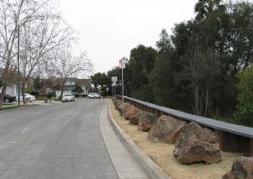
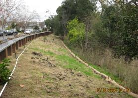
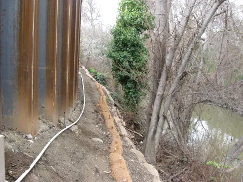
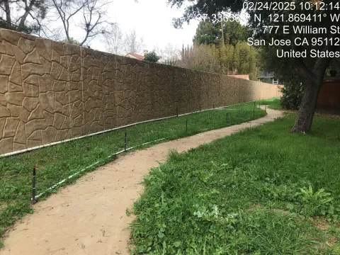
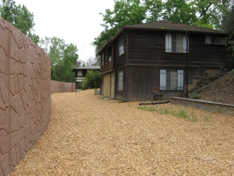
The construction of the flood risk reduction measures for the CCFMMP are in place, and a three-year plant establishment period remains. Below are maps and a summary of completed measures from Old Oakland Road to Highway 280. Workers installed metal pieces called sheet piles along Coyote Creek, using a press-in method that produces less noise than typical construction techniques. To view a video of this work in action, click here.
Completed CCFMMP Flood Risk Reduction Measures
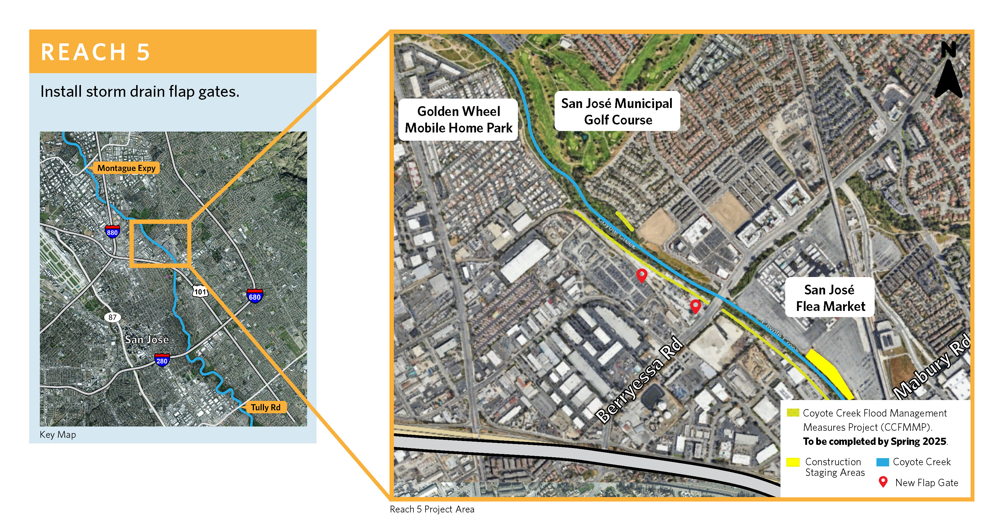
Reach 5: San Jose Municipal Golf Course to Mabury Rd and creek ownership map, reach 5.
Crews installed floodwalls along the west bank of Coyote Creek north and south of Berryessa Rd. and on a portion of Notting Hill Dr.
Reach 6: Mabury Rd. to U.S. Highway 101 and creek ownership map, reach 6
Crews installed floodwalls along the west bank of Coyote Creek north of Highway 101 and south of Mabury Road.
Reach 7: Santa Clara Street to South end of William Street Park and creek ownership map, reach 7
Crews installed floodwalls along the west bank of Coyote Creek north of East San Antonio Street and south of Santa Clara Street.
Mid-2026 Construction site-maps
The Coyote Creek Flood Protection Project (CCFPP) is in the design phase. The following maps provide details of the locations and type of flood risk reduction measures.
- Reach 4: Montague Expressway to E. Brokaw Rd.
- Reach 5: Oakland Road to Mabury Road
- Reach 6: Mabury Rd to East bank of Coyote Creek behind Empire Gardens Elementary School
- Reach 7: Coyote Creek Classroom to Selma Olinder Park/Highway 280
- Reach 8: Highway 280 to Tully Rd.
Progress on Coyote Creek Video and Blog Posts
Click here to see our progress in action as crews install floodwalls along Coyote Creek in San Jose. Visit Valley Water's News Blog to read about the projects and community input.
Past public meetings
Materials from past public meetings are located in the Reports & Documents section.
Are you Flood Ready?
Climate change has made extreme weather the new normal, and as the rainy season approaches, Valley Water encourages you to take some time to ensure you are ready in case of a flood. It’s important to remember that floods can happen anytime it rains.
It’s important to plan ahead in the event of a flood or any other emergency. Follow these Get Flood Ready essential flood tips to keep your family, home, and business safe and prepared BEFORE an emergency. You can also view our 2026 'Be Alert, Be Flood Safe' flipbook, which provides valuable flood safety and preparation information in four languages.
January 2026
For more information:
- CCFMMP or Phase 1 – Robert Yamane, (408) 630-2925
- CCFPP or Phase 2 – Caitlin McAlpine, (408) 630-2202
- Project Outreach: Jose Villarreal, (408) 630-2879
- Sign up to receive project updates via email.